01 / Safety and emergency egress

Don't build a park you can't escape.

The Draft EIS describes the project area as the terminus of an 11.7-mile dead-end road and recognizes wildfire, flash-flood, landslide, debris-flow, and mass-wasting hazards. Before authorizing more visitors, vehicles and overnight use, the agencies should publish a route-specific evacuation analysis that shows the selected scale can be cleared safely.

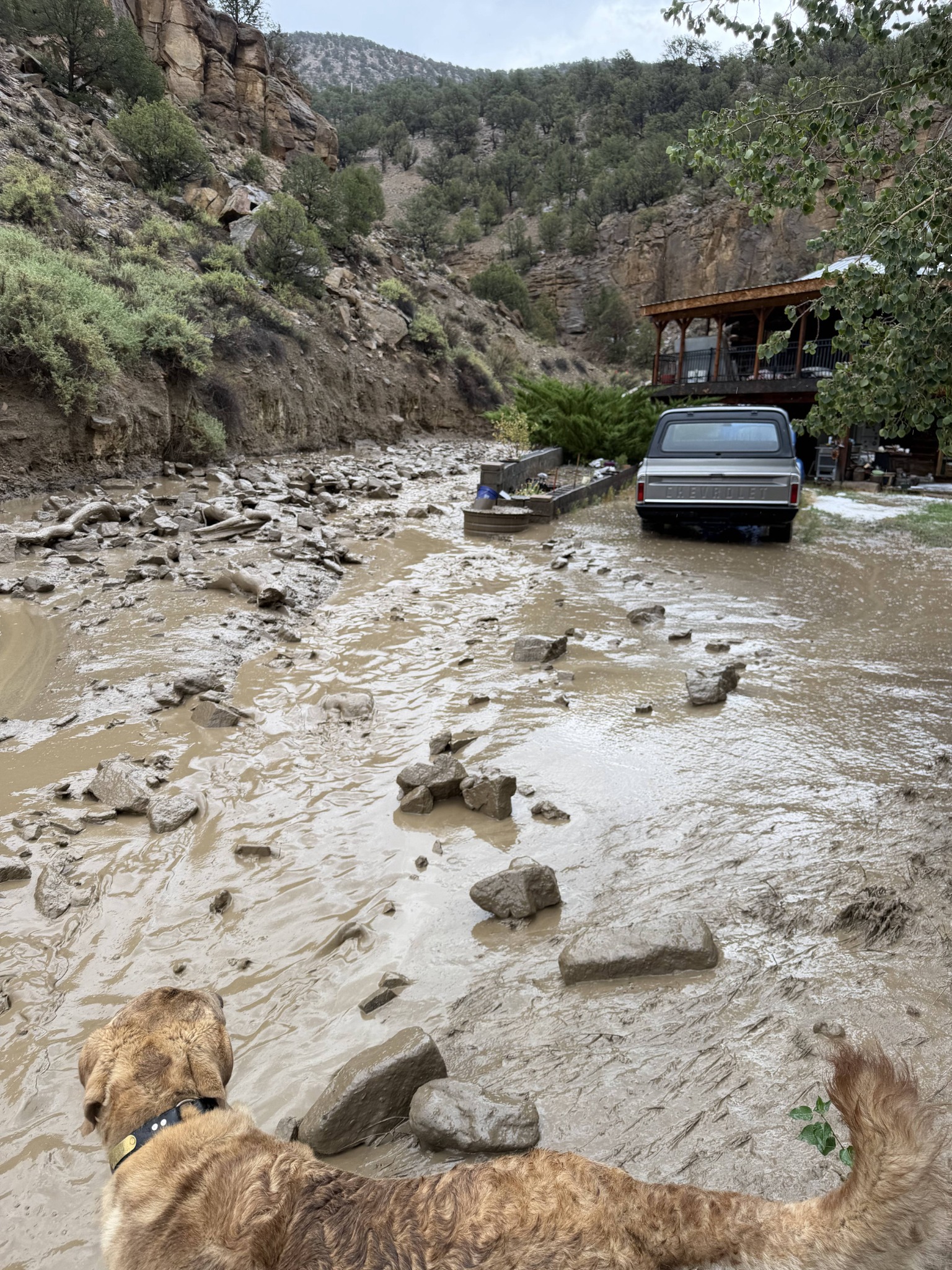
Floodwater, mud, and boulders after the August 30, 2026 Sweetwater Road storm
Flooding and debris following the August 30, 2026 storm.

What happened August 30, 2026

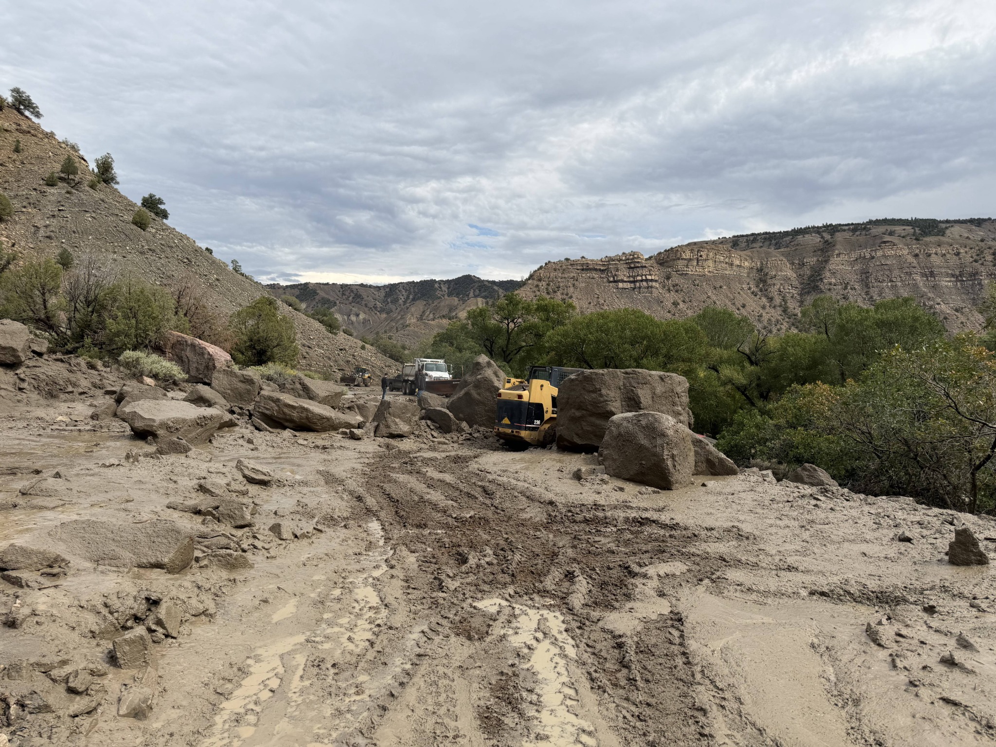
Sweetwater Road was blocked at multiple locations—including by boulders larger than the skid steer sent to clear them.

Sweetwater Road is the proposed park's only access route. For approximately six hours, Eagle County's alert system reported that Colorado River Road and Sweetwater Road both had multiple locations blocked by rock slides. Vail Daily reported rock slides and mud blocking the roads near Dotsero. CBS News Colorado reported a large mudslide with boulders and debris near the two roads. FOX31 reported that the slide completely blocked both directions of a road, and Krystal 93 reported that flooding and rockslides closed portions of both Sweetwater Road and Colorado River Road.

Road crews clear boulders and mud from Sweetwater Road after a rock slide
Sweetwater Road, August 30, 2026 · Photograph courtesy of Derrick Wiemer

Colorado Parks and Wildlife (CPW)'s own 2024 scoping comment

CPW called the analysis “critical.”

“CPW finds it critical that a robust response plan for emergencies be analyzed for each alternative within this process.”

CPW specifically identified communications, emergency egress, on-site response to critical incidents and wildfire. That is an agency statement from before the Draft EIS—not a Working Group characterization.

A recurring road hazard

This summer's closures have a documented history.

July 25, 2012

Vail Daily reported that a sudden storm closed Sweetwater Road for much of the night. Eagle County crews worked through the night to clear both Sweetwater Road and Colorado River Road; people at the resort spent the night while others downstream could not return home.

Read “Mudslides close Sweetwater Road”
August 2025

The Derby Fire prompted evacuation orders for Sweetwater Road, Sweetwater Lake and parts of Colorado River Road. During reentry, authorities kept Sweetwater Road closed to non-essential traffic and warned of flooding and flash-flood risk.

December 2023

Geologist Karen Houck documented landslides and debris flows, including active features, and warned that downstream material could damage or bury the county road and make it impassable.

Read the Houck report

National Institute of Standards and Technology (NIST) · ESCAPE

What serious no-notice evacuation planning examines.

NIST Technical Note 2262r1 presents an assessment, planning and execution framework for wildland-urban-interface fire events that can leave little or no time to evacuate. It connects pre-fire conditions and local knowledge with real-time information used during an incident.

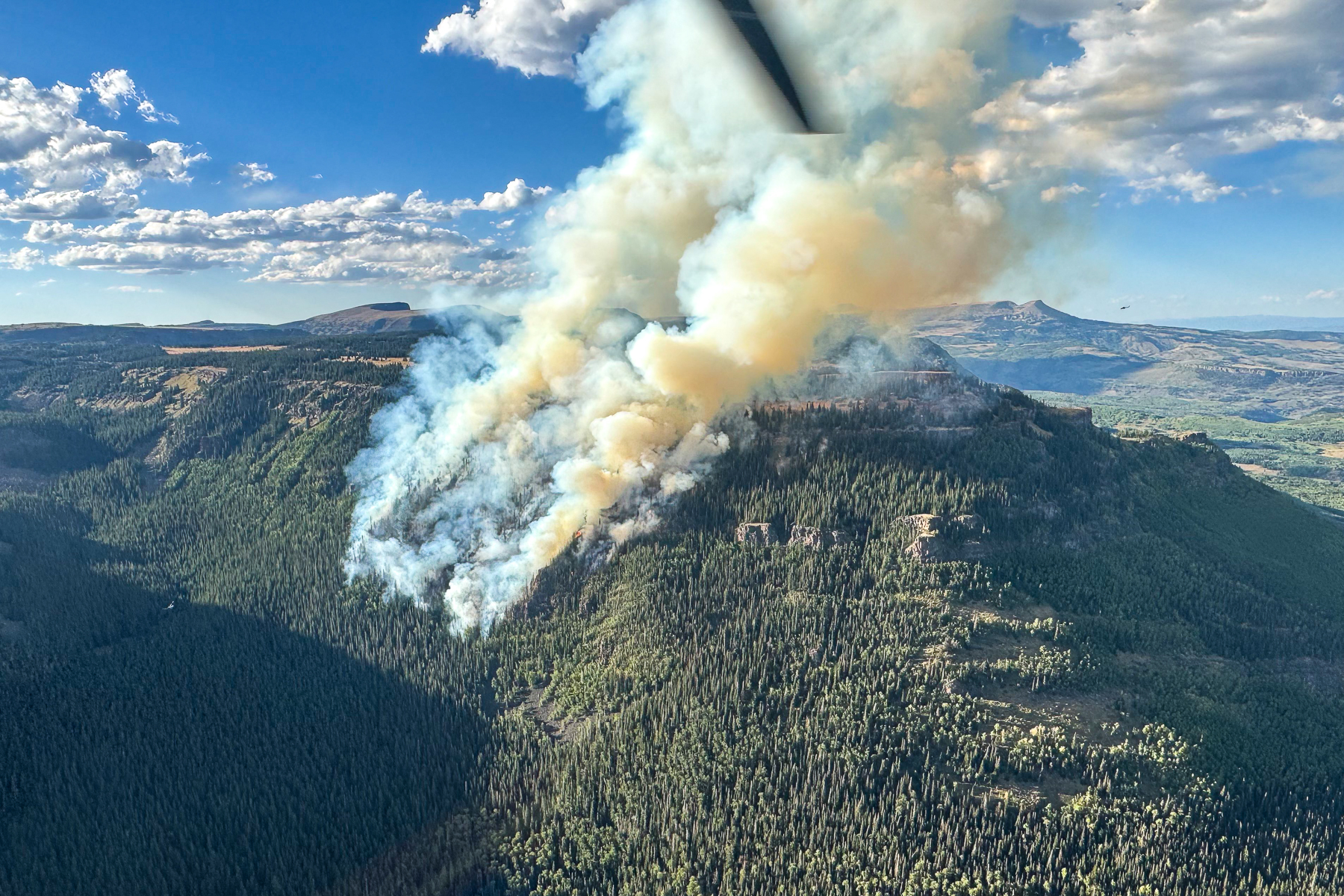
Smoke from the Derby Fire in Eagle County, Colorado
Derby Fire, August 19, 2025 · InciWeb image as published by Colorado Public Radio.

The ESCAPE framework identifies planning elements such as:

  • Evacuation time and route feasibility. Estimate the time needed to move people to safety and assess whether evacuation remains feasible as hazards approach the community or its routes.
  • No-notice contingencies. Prepare for an event that outpaces warning, including options when an evacuation route is compromised.
  • Decision zones and real-time conditions. Use anticipated fire impacts and current evacuation feasibility to inform changing response decisions.
  • Temporary Fire Refuge Areas and safety zones. Identify and prepare last-resort locations in advance for circumstances when evacuation is no longer possible.
  • Public communication and responder readiness. Establish information, procedures and communications before an incident—not after traffic or hazards have closed the route.
Read NIST Technical Note 2262r1 →

The decision standard

Four things the record should contain before approval.

  1. 01
    Independent route analysis

    Model residents, visitors, employees, large vehicles and incoming responders under realistic fire and debris-flow scenarios.

  2. 02
    Reliable secondary egress

    Establish a workable alternate route—or select a scale that does not depend on an unproved one-road evacuation.

  3. 03
    Clearance-time results

    Publish assumptions, vehicle counts, bottlenecks, blockage scenarios and the time required to clear the corridor.

  4. 04
    Binding limits

    Put occupancy, vehicle, closure and emergency conditions in the decision and permit, not only in plans drafted later.

The public record is open

Ask for proof before approval.

Request a route-specific evacuation analysis and enforceable, project-specific wildlife protections in the decision and permit.